Vöötschüpe
County of Vöötschüpe kæn-rós-fó-chy-pe Kaanrööss Vöötschüpe | |
|---|---|
|
Flag | |
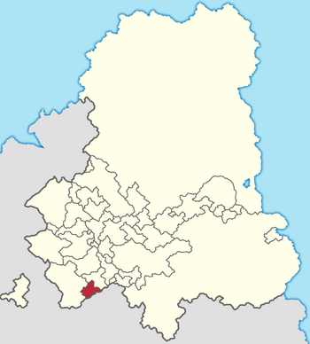
 Location of Vöötschüpe in the Gintem Confederation | |
| Capital | X |
| Official languages | Tschintierst |
| Demonym(s) | Vöötschüp |
| Government | Monarchy |
| State in the Gintem Confederation | |
| Area | |
• | 2,247.2506 km2 (867.6683 sq mi) |
| Population | |
• Census | 94,385 |
• Density | 42/km2 (108.8/sq mi) |
