Administrative divisions of Dhimrai: Difference between revisions
Jump to navigation
Jump to search
Content added Content deleted
mNo edit summary |
m (→Countries) |
||
| (7 intermediate revisions by the same user not shown) | |||
| Line 5: | Line 5: | ||
==Countries== |
==Countries== |
||
{{main|Commonwealth of Dhimrai}} |
{{main|Commonwealth of Dhimrai}} |
||
| − | Constituent countries are the highest-level subdivisions of the Commonwealth. Each is subdivided into |
+ | Constituent countries are the highest-level subdivisions of the Commonwealth. Each is subdivided into baronies and has their own Assembly, which is a devolved, unicameral legislature acting under the [[Government of Dhimrai|Royal Assembly of the Commonwealth]]. The only exception to this is Dhimrai itself, which has no local legislature. |
{| class="wikitable" |
{| class="wikitable" |
||
| Line 62: | Line 62: | ||
{| class="wikitable sortable" |
{| class="wikitable sortable" |
||
|- |
|- |
||
| − | ! colspan=" |
+ | ! colspan="3" |Barony |
! Capital |
! Capital |
||
! Population |
! Population |
||
! Area<br>{{small|(km²)}} |
! Area<br>{{small|(km²)}} |
||
! Population<br>density {{small|(people/km²)}} |
! Population<br>density {{small|(people/km²)}} |
||
| + | ! Region |
||
|- |
|- |
||
| − | | [[File:Jvuzrada flag.png| |
+ | | [[File:Jvuzrada flag.png|120px]] |
| '''[[Jvuzrada Capital Territory]]''' |
| '''[[Jvuzrada Capital Territory]]''' |
||
| + | | [[File:JCT map.png|200px]] |
||
| [[Jvuzrada]] |
| [[Jvuzrada]] |
||
| 3,836,560 |
| 3,836,560 |
||
| |
| |
||
| |
| |
||
| + | | North |
||
|- |
|- |
||
| − | | [[File:Ganipara flag.png| |
+ | | [[File:Ganipara flag.png|120px]] |
| '''[[Ganipara (barony)|Ganipara]]''' |
| '''[[Ganipara (barony)|Ganipara]]''' |
||
| + | | [[File:Ganipara map.png|200px]] |
||
| [[Ganipara (city)|Ganipara]] |
| [[Ganipara (city)|Ganipara]] |
||
| 4,714,700 |
| 4,714,700 |
||
| |
| |
||
| |
| |
||
| + | | North |
||
|- |
|- |
||
| − | | [[File:Gharidzi flag.png| |
+ | | [[File:Gharidzi flag.png|120px]] |
| '''[[Gharidzi]]''' |
| '''[[Gharidzi]]''' |
||
| + | | [[File:Gharidzi map.png|200px]] |
||
| [[Citsuri]] |
| [[Citsuri]] |
||
| 2,444,830 |
| 2,444,830 |
||
| |
| |
||
| |
| |
||
| + | | North |
||
|- |
|- |
||
| |
| |
||
| '''[[Svilegharidzi]]''' |
| '''[[Svilegharidzi]]''' |
||
| + | | [[File:Svilegharidzi map.png|200px]] |
||
| [[Vuridikse]] |
| [[Vuridikse]] |
||
| 2,101,790 |
| 2,101,790 |
||
| |
| |
||
| |
| |
||
| + | | Central |
||
|- |
|- |
||
| − | | [[File:Jdversigi flag.png| |
+ | | [[File:Jdversigi flag.png|120px]] |
| '''[[Jdversigi (barony)|Jdversigi]]''' |
| '''[[Jdversigi (barony)|Jdversigi]]''' |
||
| + | | [[File:Jdversigi map.png|200px]] |
||
| [[Mlasteti]] |
| [[Mlasteti]] |
||
| 5,679,410 |
| 5,679,410 |
||
| |
| |
||
| |
| |
||
| + | | North |
||
| ⚫ | |||
| ⚫ | |||
| + | | '''[[Mchevani]]''' |
||
| + | | [[File:Mchevani map.png|200px]] |
||
| + | | [[Chomdeta]] |
||
| ⚫ | |||
| ⚫ | |||
| ⚫ | |||
| + | | North |
||
| ⚫ | |||
| ⚫ | |||
| + | | '''[[Khalatskhe]]''' |
||
| + | | [[File:Khalatskhe map.png|200px]] |
||
| + | | [[Irtsmen]] |
||
| ⚫ | |||
| ⚫ | |||
| ⚫ | |||
| + | | North |
||
|- |
|- |
||
| |
| |
||
| '''[[Zabin]]''' |
| '''[[Zabin]]''' |
||
| + | | [[File:Zabin map.png|200px]] |
||
| [[Juliris]] |
| [[Juliris]] |
||
| 3,157,040 |
| 3,157,040 |
||
| |
| |
||
| |
| |
||
| + | | North |
||
|- |
|- |
||
| − | | [[File:Naksimeni flag.png| |
+ | | [[File:Naksimeni flag.png|120px]] |
| '''[[Naksimeni]]''' |
| '''[[Naksimeni]]''' |
||
| + | | [[File:Naksimeni map.png|200px]] |
||
| [[Dberibsva]] |
| [[Dberibsva]] |
||
| 2,533,940 |
| 2,533,940 |
||
| |
| |
||
| |
| |
||
| + | | Central |
||
|- |
|- |
||
| |
| |
||
| '''[[High Rakshili]]''' |
| '''[[High Rakshili]]''' |
||
| + | | [[File:High Rakshili map.png|200px]] |
||
| − | | |
||
| + | | [[Aqmira]] |
||
| 1,696,350 |
| 1,696,350 |
||
| |
| |
||
| |
| |
||
| + | | South |
||
|- |
|- |
||
| |
| |
||
| '''[[North Triangle Sea]]''' |
| '''[[North Triangle Sea]]''' |
||
| + | | [[File:North Triangle Sea map.png|200px]] |
||
| [[Tsvali]] |
| [[Tsvali]] |
||
| 75,040 |
| 75,040 |
||
| |
| |
||
| |
| |
||
| + | | Triangle Sea |
||
|- |
|- |
||
| |
| |
||
| '''[[South Triangle Sea]]''' |
| '''[[South Triangle Sea]]''' |
||
| + | | [[File:South Triangle Sea map.png|200px]] |
||
| ⚫ | |||
| + | | [[Qtevia]] |
||
| 44,890 |
| 44,890 |
||
| |
| |
||
| |
| |
||
| + | | Triangle Sea |
||
|- |
|- |
||
| + | | [[File:Ebsheneta flag.png|120px]] |
||
| ⚫ | |||
| + | | '''[[Ebsheneta (barony)|Ebsheneta]]''' |
||
| ⚫ | |||
| + | | [[File:Ebsheneta map.png|200px]] |
||
| ⚫ | |||
| + | | [[Ebsheneta (city)|Ebsheneta]] |
||
| ⚫ | |||
| ⚫ | |||
| ⚫ | |||
| ⚫ | |||
| − | | |
||
| − | | |
||
| − | | |
||
| ⚫ | |||
| − | | |
||
| − | | |
||
| ⚫ | |||
| − | | |
||
| − | | |
||
| − | | |
||
| 991,600 |
| 991,600 |
||
| |
| |
||
| |
| |
||
| + | | Central |
||
|- |
|- |
||
| + | | [[File:Kaghbagra.png|120px]] |
||
| − | | |
||
| + | | '''[[Kaghbagra]]''' |
||
| − | | |
||
| + | | [[File:Kaghbagra map.png|200px]] |
||
| − | | |
||
| + | | [[Amrioda]] |
||
| 1,314,540 |
| 1,314,540 |
||
| |
| |
||
| |
| |
||
| + | | South |
||
|- |
|- |
||
| + | | [[File:Bardomdze flag.png|120px]] |
||
| − | | |
||
| + | | '''[[Bardomdze]]''' |
||
| − | | |
||
| + | | [[File:Bardomdze map.png|200px]] |
||
| − | | |
||
| + | | [[Khmanelpo]] |
||
| 763,800 |
| 763,800 |
||
| |
| |
||
| |
| |
||
| + | | South |
||
|} |
|} |
||
| + | |||
| + | ====Regions==== |
||
===New Dhimrai=== |
===New Dhimrai=== |
||
| Line 185: | Line 218: | ||
==Overseas Crown Territories== |
==Overseas Crown Territories== |
||
| + | |||
| + | [[Category:Dhimrai]] |
||
Latest revision as of 18:04, 30 October 2024
The administrative divisions of Dhimrai consist of several levels of subdivisions, spread across the entirety of the Commonwealth of Dhimrai.
History
Countries
Constituent countries are the highest-level subdivisions of the Commonwealth. Each is subdivided into baronies and has their own Assembly, which is a devolved, unicameral legislature acting under the Royal Assembly of the Commonwealth. The only exception to this is Dhimrai itself, which has no local legislature.
| Country | Population | % Commonwealth population |
Population density (people/km2) |
Area (km2) |
% Commonwealth area |
|---|---|---|---|---|---|
| 35,152,000 | X% | 159.63 | 220,215 | X% | |
| X | X% | X | X | X% | |
| X | X% | X | X | X% | |
| 74,000 | X% | 4.41 | 16,787 | X% | |
| X | X% | X | X | X% | |
| Commonwealth of Dhimrai | 100.0% | 100.0% |
Baronies
Dhimrai
| Barony | Capital | Population | Area (km²) |
Population density (people/km²) |
Region | ||
|---|---|---|---|---|---|---|---|

|
Jvuzrada Capital Territory | 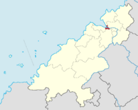
|
Jvuzrada | 3,836,560 | North | ||

|
Ganipara | 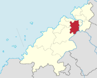
|
Ganipara | 4,714,700 | North | ||

|
Gharidzi | 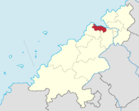
|
Citsuri | 2,444,830 | North | ||
| Svilegharidzi | 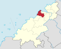
|
Vuridikse | 2,101,790 | Central | |||

|
Jdversigi | 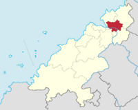
|
Mlasteti | 5,679,410 | North | ||
| Mchevani | 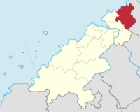
|
Chomdeta | 2,116,530 | North | |||
| Khalatskhe | 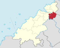
|
Irtsmen | 3,680,980 | North | |||
| Zabin | 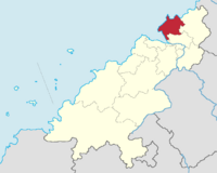
|
Juliris | 3,157,040 | North | |||

|
Naksimeni | 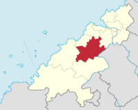
|
Dberibsva | 2,533,940 | Central | ||
| High Rakshili | 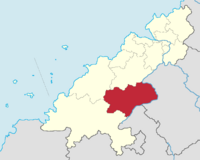
|
Aqmira | 1,696,350 | South | |||
| North Triangle Sea | 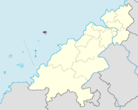
|
Tsvali | 75,040 | Triangle Sea | |||
| South Triangle Sea | 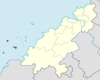
|
Qtevia | 44,890 | Triangle Sea | |||

|
Ebsheneta | 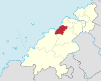
|
Ebsheneta | 991,600 | Central | ||

|
Kaghbagra | 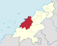
|
Amrioda | 1,314,540 | South | ||

|
Bardomdze | 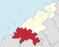
|
Khmanelpo | 763,800 | South | ||